PHOTOGRAPHER
Jose Mtanous E-MAIL
jmtanous@gmail.com LOCATION
Hotel Termas de San Joaquin DATE
2011-03-05 and 2011-03-06 EQUIPMENT
Camera QHY9M for Luminance QHY8L for Color Telescope Televue NP101is @ f/4.3 (for L) William Optics Megrez 90 @ f/5 (for RGB) Mount Celestron CCE Exposure 50 x 10min for L 37 x 10min for RGB Total exposure time: 14h Processing Acquired and Calibrated with Nebulosity. Stacked, Stretched, Cropped, Saturated and resampled with Pixinsight SQM: 21 DESCRIPTION
Leo triplet and NGC3628 tidal tail.
"WXtrack is free, and is one of the best tracking programs that I have come across" - Radio Active April 2001
"...a satellite tracking program with a superbly crafted tracking window..." - Remote Imaging Group Journal 58
"...as up to date as any...", "...an impressive program..." - Monitoring Times, August 1999
"..the excellent "WXtrack" software .... I've used WXtrack in various outreach programs to high schools and recommend it." - Professor Bill Cowley, Director, Institute for Telecommunications Research, Satellite Comms Program Leader, CRC for Satellite Systems
"It was a pleasure to find a well-crafted package" - MD Robotics - makers of the Canadarm used on the Space Shuttle and Station
"I have used your program quite a bit now and I absolutely love it. It is the best tracking program I have ever used and I have used them all I am sure :)" - Mark Kyle
"WXtrack is, by far, the most economical, flexible, and informative satellite tracking and display package available today. It will be prominently displayed in our Data Processing Center to show the current, historical, or future location of our "A-Train" satellites and tracking sites. Kudos to David Taylor for an exceptional satellite application" - Don Reinke, NASA CloudSat Mission Data Processing Center. (CIRA)
"I wrote Quiktrak and for years it was the mainstay of the amateur and in some cases professional tracking world. After seeing WXtrack, there is no need for me to ever revisit that offering. I am happy to register this software" - Bob McGwier, N4HY. Vice President for Engineering, AMSAT-NA
"WXtrack is a great program - I believe to be the best available." - Kevin Nice, Nice One Publishing Limited
WXtrack is used by many Universities and satellite enthusiasts across the world, and is also used with the industry. If you would like a custom version for your project, just e-mail me. See WXtrack in Embarcadero' Delphi Application Showcase!
Processor: Pentium 90 or better, 200MHz or better recommended
Memory: 32MB or better, 64MB highly recommended.
Display: 800 x 600 resolution or better, 15-, 16- 24- or 32-bit colour recommended.
WXtrack works best with Normal font size.
The runtime Library Bundle listed below is necessary for WXtrack to function. If you get error messages about missing DLLs when you try to run WXtrack, please consult the library notespage.
The Country & State boundary data is required if you wish to generate image overlays for adding to actual pictures with SatSignal, and for certain map projections. If you have less than 32MB memory in your system and want to run overlays, it may be worthwhile downloading the Pre-compiled overlay bitmap as the program will struggle to generate the 31MB bitmap in a 24MB or less system! Copy the expanded Overlay.bmp file to the program's executable folder. If you wish to change grid-line spacing, add longitude and latitude annotation, or put the grid on top of the countries, please download MakeOverlay program listed under optional items below.
If you have a problem with your PC being permanently set on Daylight Saving time, which happens with certain versions of Windows 98, try the Time Zone Editor from the Microsoft Windows 2000 Resource Kit. This program, TZEdit, enables you to define your Time Zone details. More information.
If you are driving a tracker in real-time, be sure your PC is keeping accurate time.
The Version 2.26 update is minor, and allows user selected features (Sun, Moon, Orbit Tracks) to be saved in the footprint.ini file and load as default settings.
New Easy-Install Package
This new installer allows you to install Footprint in acustom folder, add Desktop and/or Taskbar short-cut icons and features a fully functional uninstaller.
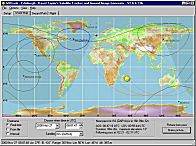
This version of Footprint has been designed under Windows XP, and also operates under
Windows 2000. It is designed to fill a 1024×768 PC screen.
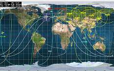
Orbitron is a satellite tracking system for radio amateur and observing purposes. It's also used by weather professionals, satellite communication users, astronomers, UFO hobbyist and even astrologers.
Application shows the positions of satellites at any given moment (in real or simulated time). It's FREE (Cardware) and it's probably one of the easiest and most powerful satellite trackers, according to opinions of thousands of users from all over the world. I'm still working on it, waiting for your opinions and bug reports. Please try it. If you like it - tell your friends about it and send me a postcard...
FEATURES:
NORAD SGP4/SDP4 prediction models
20 000 satellites can be loaded from TLE file(s) (auto: PC/Unix, 2/3 line)
ALL of them can be tracked at the same time
Sun and Moon tracking
Full-screen, presentation modes
Supported screen resolutions from 640x480
Real-time mode / Simulation mode (free time control)
Orbital prediction is determining where a particular object will be at a particular time (past, present or future). This can be done with a general mathematical description of the motion of the satellite (in other words, some equations), and some parameters specific to a particular satellite. The parameters essentially describe a position at a particular point in time (called the epoch), as well as the speed and direction of the object at that time. The most common parameter set is called the Keplerian Elements.Satellite tracking is aiming your binoculars, telescope, or radio antenna (beam or dish) at the predicted location of the satellite, and then following its predicted motion. Depending on the circumstances, this can be an entirely automated procedure, or it can be as simple as looking up at the proper quadrant of the sky at the right time, according to a pre-printed table (called an "ephemeris").
These topics are particularly interesting to amateur radio operators, since there are a number of artificial earth satellites which serve as radio relay stations for "hams". TVRO enthusiasts may also be interested in expanding their knowledge beyond the geostationary satellites (which are particularly easy to track since they don't appear to move). Others may be interested in visually observing the space station Mir, the space shuttle, or other objects. Some satellites can also be heard on simple scanner radios, and interesting information including pictures of the earth from weather satellites can be decoded from their transmissions.
Preview the online help file. These pages are a bit out of date, but give the general idea. Please refer to the help file actually delivered with your copy of the program for the correct description of current features. These pages were created from the Windows Help Compiler source files using the WinHelp to Web converter by Jean-Phillipe Donnio.
In the Telescope Techniques department in the August 2000 issue ofSky & Telescope(PDF of article), associate editor Gary Seronik and telescope maker Alan Adler discuss how to determine the optimal size of a secondary mirror for a Newtonian telescope. Adler provided a helpful DOS utility calledSec,which you candownload here. Be sure to select "Save program to disk" when prompted.
In the Telescope Techniques department in the November 2000 issue ofSky & Telescope(PDF of article) Alan Adler described a revolutionary way of shaping telescope mirrors that circumvents much of the labor needed to grind a paraboloidal mirror. Adler took a spherical mirror and flexed it to produce a paraboloid. The article features a DOS program calledFlexto simplify the process, which you candownload here. Be sure to select "Save program to disk" when prompted, and unzip the file using an uncompressing utility, such as7-ziporStuffIt Expander.
In the Telescope Techniques department in the January 2002 issue ofSky & Telescope(PDF of article) Alan Adler explains how forcing airflow over the primary mirror of a Newtonian reflector dramtically improves performance. The article features a DOS program calledCoolthat models the effects of different thermal situations. You candownload it here. Be sure to select "Save program to disk" when prompted.
Binoplan— Design specs for right-angle, correct-view binoculars In the Telescope Techniques department in the July 2002 issue of Sky & Telescope (PDF of article) Glenn LeDrew showed how to make a pair of right-angle, correct-view binoculars. The article features a DOS program called Binoplan that calculates the spacing of the various optical elements and shows on-axis and off-axis vignetting. You can download it here. Be sure to select "Save program to disk" when prompted, and unzip the file using an uncompressing utility, such as 7-zip or StuffIt Expander.
Leandro Rios, an amateur astronomer in Argentina, created this handy utility for Mars watchers. Rios based his freeware program — which displays the central meridian and angular size of the red planet for any date and time — on the algorithm used in MARS.BAS (in the S&T Basic Programs listings). The program is a 32-bit application (Windows 95 and higher).
After you download mp201.zip (3.0 megabytes), unzip it and run setup.exe to install the software. (To extract the files, use an uncompressing utility, such as 7-zip or StuffIt Expander). NOTE added July 3, 2003: We obtained our copy of mp201.zip directly from the author, months before a virus-infected copy was posted on AstronomySight.com and publicized by Astronomymagazine. Our copy of mp201.zip is certified virus free!
When you run Mars Previewer, make sure you enter dates in DD/MM/YYYY format and set your time zone relative to Greenwich Mean Time (positive numbers to the west, negative to the east). If you have any questions about the program, you can contact Rios by e-mail at leandror@iname.net.
SkyNews- if you are not familiar with Canada's magazine of astronomy and stargazing, please browse around the site. You might want to start with a peek at our current issue or some sample articles by Terence Dickinson, Alan Dyer and Ken Hewitt-White. SkyNews has plenty to offer the astronomy buff.
Sky & Telescopehas been the worlds leading source of accurate and up-to-date information about astronomy and space science. Edited for the full spectrum of active astronomy enthusiasts worldwide, from novice, devoted amateur to professional.
March 16, 2011: Mark your calendar. On March 19th, a full Moon of rare size and beauty will rise in the east at sunset. It's a super "perigee moon"--the biggest in almost 20 years.
"The last full Moon so big and close to Earth occurred in March of 1993," says Geoff Chester of the US Naval Observatory in Washington DC. "I'd say it's worth a look."
Full Moons vary in size because of the oval shape of the Moon's orbit. It is an ellipse with one side (perigee) about 50,000 km closer to Earth than the other (apogee): diagram. Nearby perigee moons are about 14% bigger and 30% brighter than lesser moons that occur on the apogee side of the Moon's orbit.
"The full Moon of March 19th occurs less than one hour away from perigee--a near-perfect coincidence1 that happens only 18 years or so," adds Chester.
A perigee full Moon brings with it extra-high "perigean tides," but this is nothing to worry about, according to NOAA. In most places, lunar gravity at perigee pulls tide waters only a few centimeters (an inch or so) higher than usual. Local geography can amplify the effect to about 15 centimeters (six inches)--not exactly a great flood.
The Moon looks extra-big when it is beaming through foreground objects--a.k.a. "the Moon illusion."
Indeed, contrary to some reports circulating the Internet, perigee Moons do not trigger natural disasters. The "super moon" of March 1983, for instance, passed without incident. And an almost-super Moon in Dec. 2008 also proved harmless.
Okay, the Moon is 14% bigger than usual, but can you really tell the difference? It's tricky. There are no rulers floating in the sky to measure lunar diameters. Hanging high overhead with no reference points to provide a sense of scale, one full Moon can seem much like any other.
The best time to look is when the Moon is near the horizon. That is when illusion mixes with reality to produce a truly stunning view. For reasons not fully understood by astronomers or psychologists, low-hanging Moons look unnaturally large when they beam through trees, buildings and other foreground objects. On March 19th, why not let the "Moon illusion" amplify a full Moon that's extra-big to begin with? The swollen orb rising in the east at sunset may seem so nearby, you can almost reach out and touch it.
Don't bother. Even a super perigee Moon is still 356,577 km away. That is, it turns out, a distance of rare beauty.
1Footnote: Less-perfect perigee moons occur more often. In 2008, for instance, there was a full Moon four hours from perigee. Many observers thought that one looked great, so the one-hour perigee moon of 2011 should be a real crowd pleaser.
Keywords:
3D Model
Spacecraft
Satellite
OSTM/Jason-2
Earth Science
Eyes on the Earth 3D
OSTM/Jason-2's primary payload includes five instruments similar to those aboard Jason-1, along with three experimental instruments. Its main instrument is an altimeter that precisely measures the distance from the satellite to the ocean surface. Its radiometer measures the amount of water vapor in the atmosphere, which can distort the altimeter measurements. Three location systems combine to measure the satellite's precise position in orbit.
Please review the Usage Guidelines page before using this model.
Keywords:
3D Model
Spacecraft
Satellite
Aqua
Earth Science
Eyes on the Earth 3D
A-Train
Water
Aqua carries six state-of-the-art instruments to observe the Earth's oceans, atmosphere, land, ice and snow covers, and vegetation, providing high measurement accuracy, spatial detail, and temporal frequency. This comprehensive approach to data collection enables scientists to study the interactions among the four spheres of the Earth system -- the oceans, land, atmosphere, and biosphere.
Please review the Usage Guidelines page before using this model.
Keywords:
3D Model
Spacecraft
Satellite
CloudSat
Earth Science
Eyes on the Earth 3D
A-Train
Launched in April 2006, CloudSat monitors the state of the Earth’s atmosphere and weather with a sophisticated radar system. The instrument, jointly developed with the Canadian Space Agency, can predict which clouds produce rain, observe snowfall, and monitor the moisture content of clouds.
Please review the Usage Guidelines page before using this model.
Keywords:
3D Model
Spacecraft
Satellite
Jason 1
Earth Science
Eyes on the Earth 3D
Jason 1 is an oceanography mission to monitor global ocean circulation, study the ties between the oceans and atmosphere, improve global climate forecasts and predictions, and monitor events.
Please review the Usage Guidelines page before using this model.


